Kamnik-Savinja Alps
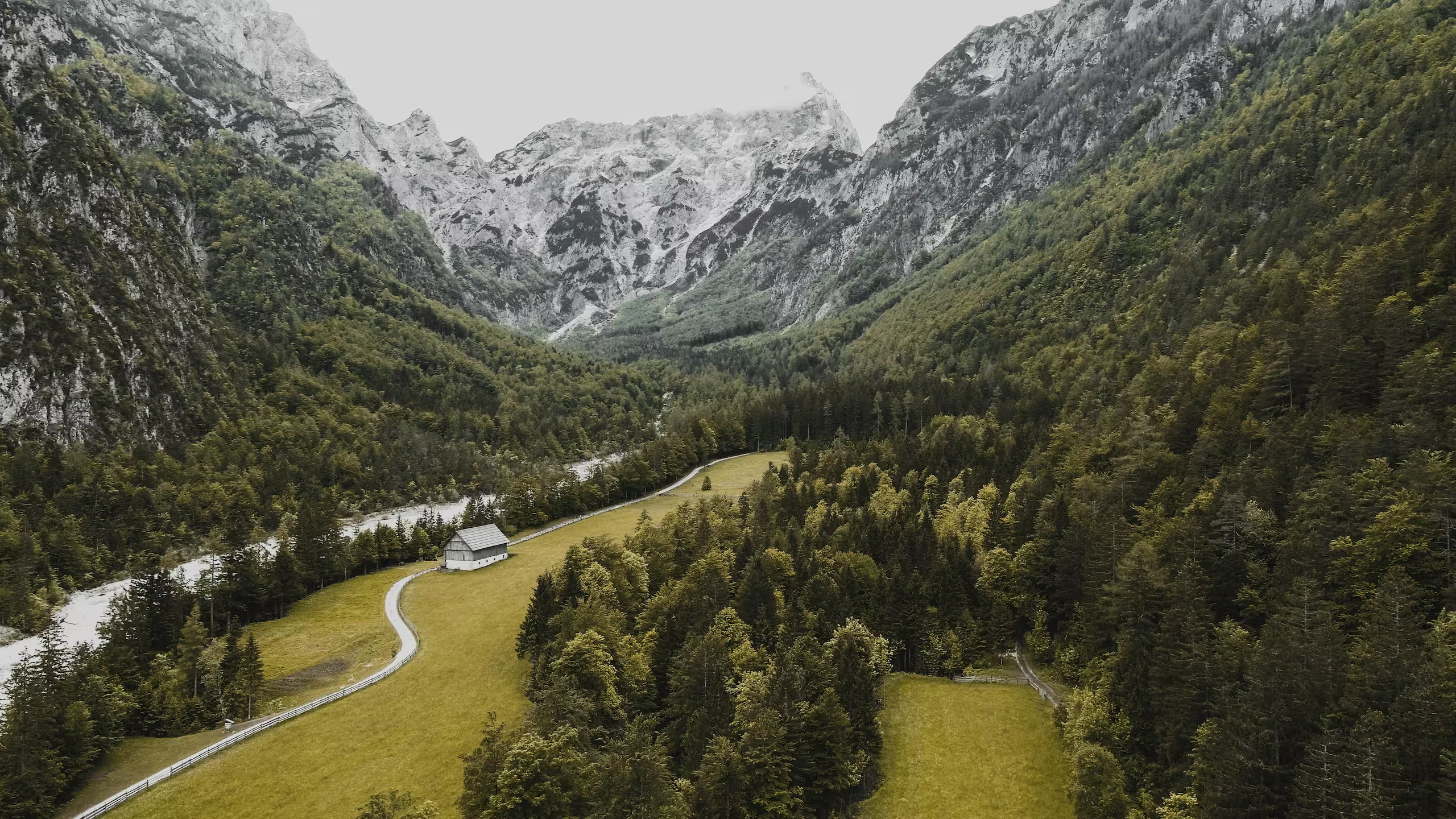
The Kamnik-Savinja Alps are the mountains you can see from Ljubljana and that hardly anyone visits. Velika Planina, the Logar Valley, Kamnik and Jezersko in one guide, with what you need to know about the cable car this autumn.
The Kamnik-Savinja Alps are located north of Ljubljana, between the Julian Alps and Koroška. We include Kamnik, Velika Planina, Jezersko, Solčava and the entire upper reaches of the Savinja with Logarska dolina and Robanov kot. Note the name: Celje and Žalec are further downstream and can be found under Eastern Slovenia.
This is the region for those who find the Julian Alps too busy but still want mountains. Kamnik is 24 kilometres from Ljubljana, the cable car to Velika Planina departs fifteen minutes away, and Logarska dolina is the country's most beautiful glacial valley that tour buses don't reach. One thing to note in advance, as it will determine your day trip: the cable car to Velika Planina will be closed for maintenance from 15 October to 15 November 2026. The plateau remains accessible on foot, and Logarska dolina and Jezersko are unaffected.
Everyone drives to Bled. The Kamnik-Savinja Alps are closer, quieter, and feature a village at 1,611 metres that is only inhabited in the summer.
Where are the Kamnik-Savinja Alps located?
The massif lies in the north of Slovenia, with the border with Austria running along the highest ridges. The Savinja rises here, in Logarska dolina. To the west, the Julian Alps begin near the Karavanke and Bled; to the south lies Central Slovenia with Ljubljana.
Five places in this area:
- Kamnik: the medieval town at the foot of the mountains and the base for your explorations.
- Velika Planina: the shepherd's plateau at 1,611 metres, with the cable car from Kamniška Bistrica.
- Kamniška Bistrica: the river valley behind Kamnik, with a waterfall and access to the mountain huts.
- Logarska Dolina and the Solčavska panoramska cesta: the glacial valley with the Rinka waterfall and the panoramic road along three valleys.
- Jezersko: the quiet valley in the north, against the Karavanke.
Krvavec, the ski resort above Cerklje just half an hour from Ljubljana, is located in the same massif and belongs to this region.

Kamnik: the medieval gateway to the mountains
Kamnik was first mentioned as a town in 1229, making it one of the oldest in Slovenia. The town is located 24 kilometers north of Ljubljana and is the place to leave your car behind when heading into the mountains. Above the center stands Mali grad, the Little Castle, home to the legend of the Kamnik Veronika: three brothers, all priests, asked her for money to build a new church; she refused and was transformed into a creature that was half woman and half snake. The story was recorded in the seventeenth century by Janez Vajkard Valvasor. After visiting the castle, walk down the main street, Šutna, with its low houses and the church at the end; you can see all of Kamnik in an hour, which is just enough for a morning.
Velika Planina: the shepherd's plateau
Velika Planina is the reason to come to this region. At an altitude of 1,611 meters lies a village of wooden shepherd huts that is only inhabited in the summer. The huts consist of a single room with oval shingle roofs that extend almost to the ground, allowing livestock to shelter underneath; it is one of the very few shepherd settlements of this size preserved in Europe. During the Second World War, the chapel and over a hundred huts were burned to the ground; the Chapel of Mary of the Snows, designed by Jože Plečnik, was rebuilt in 1988. What you find up there is not an attraction but a landscape: meadows, mist, the ridges of the Kamnik-Savinja Alps on the horizon, and in the summer, the herds and the shepherds who make trnič , the small dried cheeses of the plateau.
You can usually get there by taking the cable car from Kamniška Bistrica followed by the Šimnovec chairlift, which runs every hour on the hour between 8:00 AM and 6:00 PM during the season.

Kamniška Bistrica: waterfalls and the gateway to the huts
Beyond Kamnik, the road runs into the valley of the Kamniška Bistrica , a river that flows cold and clear from the massif. At the end of the valley, near the cable car base station, the true mountain terrain begins. A short walk leads you to the small Orglice waterfall, suitable for children and those who don't want to hike all day. Those looking to go further can take the path up to Kamniško sedlo, the saddle with the mountain hut that serves as the gateway to the high routes of the massif; Visit Kamnik counts more than five hundred climbing routes in the Kamnik-Savinja Alps. How to plan such a multi-day trip, which huts are available, and how to book them can be found in our guide on hut-to-hut hiking in Slovenia.
One point for accuracy: Kamniška Bistrica is not a protected landscape park, despite how often it is referred to as such. The municipalities of Jezersko, Kamnik, Luče, Preddvor and Solčava proposed a regional park in 2003, the ministry halted the plan in 2012 due to insufficient local support, and in 2026 it is being revived as a citizen petition. It is a natural area, not a park, and that distinction is no mere detail here.
On the other side of the valley, above Cerklje, lies Krvavec: in winter, a ski resort just half an hour from Ljubljana; in summer, a mountain biking and hiking destination. For those arriving by bike: our blog about cycling in Slovenia mentions Krvavec as the climb where Tadej Pogačar grew up.

Logarska Dolina and the Solčavska Panoramic Road
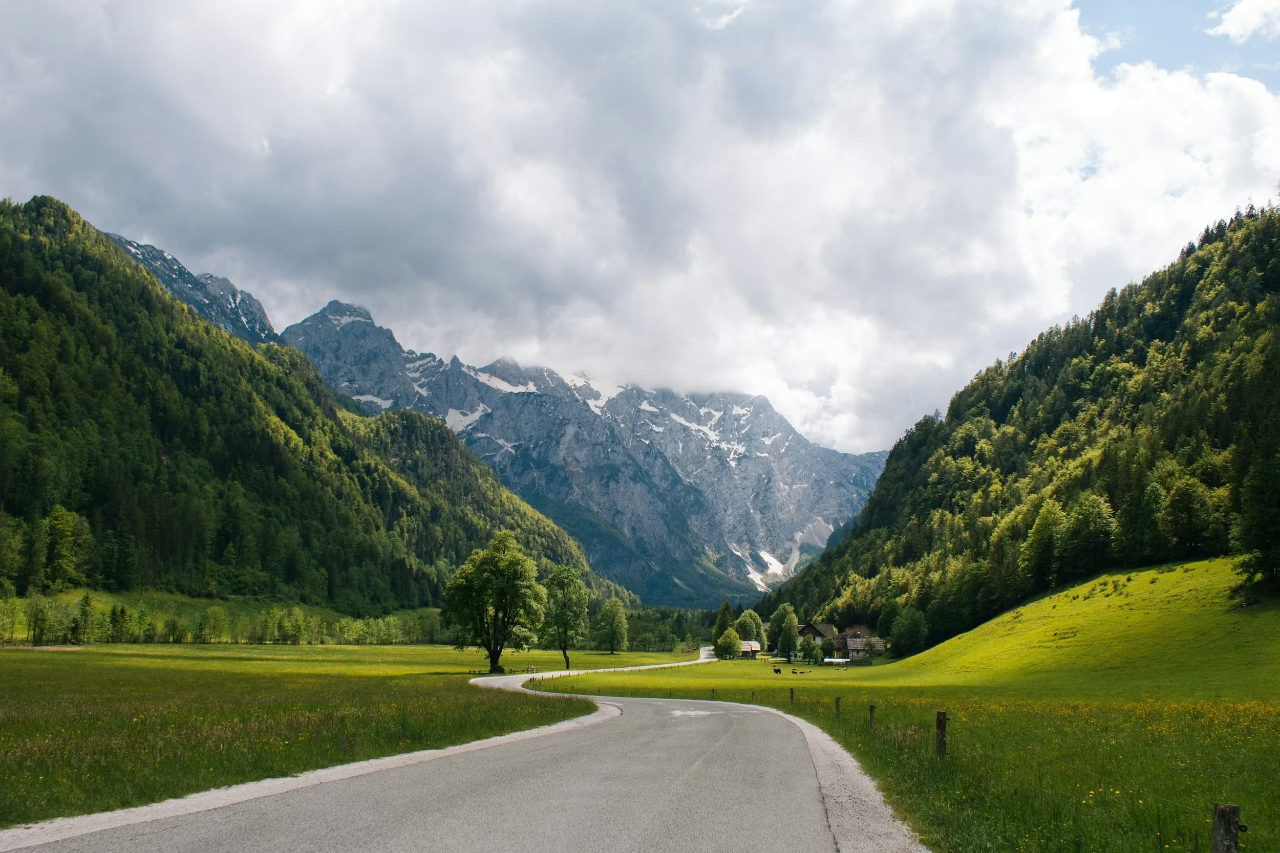
Logarska Dolina is a U-shaped glacial valley, protected as a landscape park since 1987, covering 24.75 square kilometers and about 500 meters wide at its narrowest point, with the Planjava (2,394 meters) as the highest peak in the surrounding circle of mountains. The valley is flat and ends against a rock wall. At the end, a fifteen-minute walk from the parking lot, the Rinka Waterfall drops 90 meters. That is the image of the valley, and it is doable with children: a flat path, short distance, and a snack bar below the waterfall.
You only pay if you enter by motor vehicle: €7 for a motorcycle, €10 for a car, €20 for a van, €70 for a bus, and an annual pass for a car costs €30. Access is free on foot, by bike, or on skates; those staying overnight in Solčava pay once for the entire stay. Consider these amounts as a guide price.
Logarska Dolina is one of three valleys. The Solčavska Panoramic Road, a 37-kilometer scenic route, connects it with Robanov Kot, Matkov Kot, and the mountain farms of Podolševa; a shorter 21-kilometer loop with twelve stops also exists. Drive it in the morning, with the sun in the valley and the farms on the slopes, and plan half a day for it. In winter, the road may have snow and ice. Why this valley is on our list of hidden gems of Slovenia , you can read there.
Jezersko: the quiet north
Way up in the north, against the Karavanke and the Austrian border, lie Zgornje and Spodnje Jezersko. There is one landmark, the Planšarsko jezero, a small lake at an altitude of about 900 meters, and beyond that, there is essentially nothing: no cable car, no attractions, just a few farms and the mountains. That is exactly why you should go. Jezersko is the place in this region where you can go an entire day without running into anyone, making it the only spot on this page that truly deserves the term "hidden gem." Come for the peace and quiet, stay the night, and walk into the valley the next morning before the light hits the peaks.

When should you go, how do you get there, and how many days do you need?
How do you get there?
By car. Kamnik is 24 kilometers from Ljubljana, about a 25-minute drive. The cable car base station is another 15 minutes further, at the end of the Kamniška Bistrica valley. Logarska dolina is a drive of over an hour from Kamnik, via Kranj and Jezersko or via the Zgornja Savinjska dolina, with Jezersko located in between. There is no train to Velika Planina or Logarska dolina, and the bus will only take you as far as Kamnik, so without a car, you can visit Kamnik and the valley, but not the combination. If you are traveling without a car, keep an eye out for our upcoming guide on travel and public transport in Slovenia, and rent a car for two days for this region.
How long should you stay?
One to two days for Kamnik and Velika Planina. If you also want to visit Logarska dolina and the panoramic road, plan a third day and stay in Solčava or near Logarska dolina so that the morning in the valley is all yours. Staying overnight in Kamnik or near Logarska dolina is therefore an essential part of your planning, not an afterthought.
When should you go?
The season in a nutshell. During the summer months, from June through September, the shepherds are on Velika Planina and the cable car runs every hour on the hour. In early October, you get autumn colors and an empty plateau, with the cable car operating until October 14. From October 15 through November 15, 2026, the cable car is closed, and you can only reach the top on foot. Logarska dolina is open year-round; the panoramic road may have snow and ice in winter. From December onwards, Krvavec is the place for skiing. You can read about how the months compare in the rest of the country in our guide on the best time to visit Slovenia, and which trips suit which season in our guide on hiking in Slovenia.
With children?
Yes, and it's easier than in the Julian Alps. The Logar Valley is flat, the path to the Rinka waterfall takes fifteen minutes, and there is a hut at the end; those who enter the valley on foot or by bike pay nothing. At Kamniška Bistrica, the walk to the Orglice waterfall is short. And Velika Planina, with its cable car and chairlift, is more of an outing than a climb, provided they are running. Sturdy shoes for everyone, as you'll be walking across pastures at the top.

Last verified: October 2026 | Last updated: October 2026 | Author: Mijn Slovenië Editorial Team
Sources: velikaplanina.si, visitkamnik.com, kraji.eu, logarska-dolina.si, slovenia.info, logarska-solcavsko.si, Mijn Slovenië