Juliana Trail Slovenia. 270 km loop around the Julian Alps

The Juliana Trail is a 270 km circular walk along the Julian Alps and Triglav National Park. Discover the atmosphere, highlights, best time to travel, public transport tips, and how to choose a route that suits you.
The Juliana Trail is a circular long distance hike of about 270 km, split into 16 stages. It runs along the edges of the Julian Alps and around Triglav National Park, mostly through valleys, forests, villages, rivers and lakes. A key advantage is flexibility. Many sections can be linked or shortened with local buses and trains, which helps if weather changes or you simply want a lighter day. You can hike the full loop, or use selected sections as inspiration for day hikes or a shorter multi day trip.
Why the Juliana Trail feels different
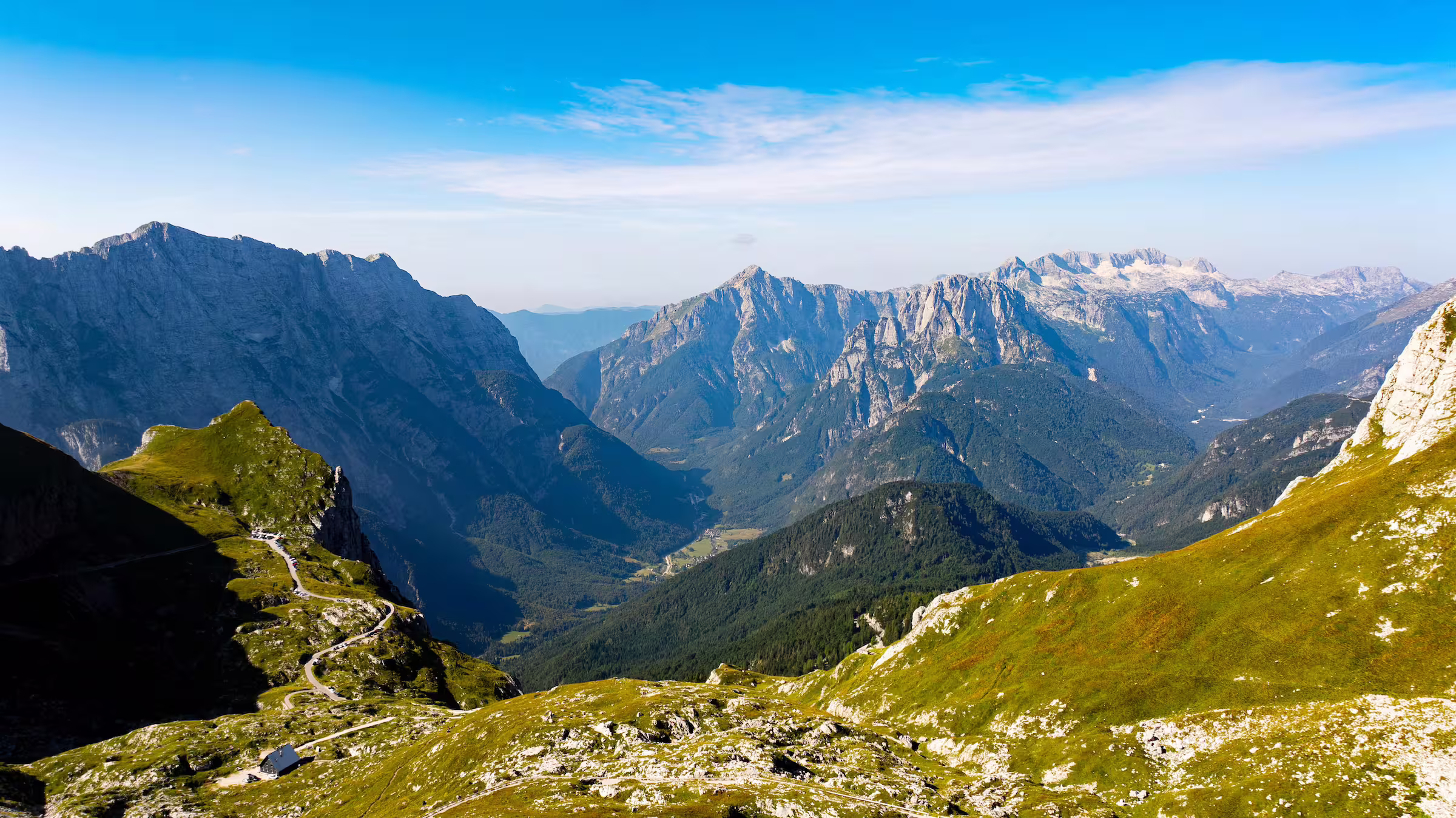
Some hiking routes are all about peaks, passes, and technical mountain terrain. The Juliana Trail offers another rhythm. You experience the alpine landscape “from below”, with wide views of high ridgelines, while walking through forests, meadows and valleys. It is ideal if you want a mountain atmosphere without turning the trip into a summit challenge.
The trail at a glance
- Total distance: about 270 km
- Number of stages: 16
- Typical length of starge: around 17 to 18 km
- Daily rhythm: many hikers enjoy 4 to 6 hour walking day including breaks
- Character: mainly through valleys and past villages, with occasional steep ascents and descents. The route is often described as accessible, because you are not continuously walking through high mountains and because you can shorten parts of it by using public transport. Most of it is on flat land.
- Markings and aids: the route is well marked and GPS tracks and route descriptions are available.
Please note: are you looking for more of a challenge? That's possible! There are four additional routes from Goriška Brda and three more to Breginjski Kot.
Highlights you will often encounter
What makes the Juliana Trail so appealing is its variety. Among other things, you will pass:
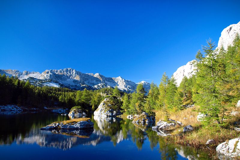
- National Park Triglav
- Soča river and valley
- Multiple water falls (Martuljek, Boka, Virje, etc.)
- Charming towns like Kranjska Gora, Radovljica and Kobarid
Three sections that often become favorites
If you want inspiration to cut your own route into beautiful sections, these are logical building blocks.
1. From Bled up to the Pokljuka plateau
A route where you can feel the contrast between more, ravine, forest, and high plateau. This is one of those days when you really get to explore the mountains without having to reach the summit right away.
2. From Pokljuka down towards Bohinj
After the plateau, there is a long descent through forests and meadows towards the Bohinj Valley. Ideal if you enjoy a day with a clear route and a reward at the end in the form of the lake and the tranquility surrounding it.
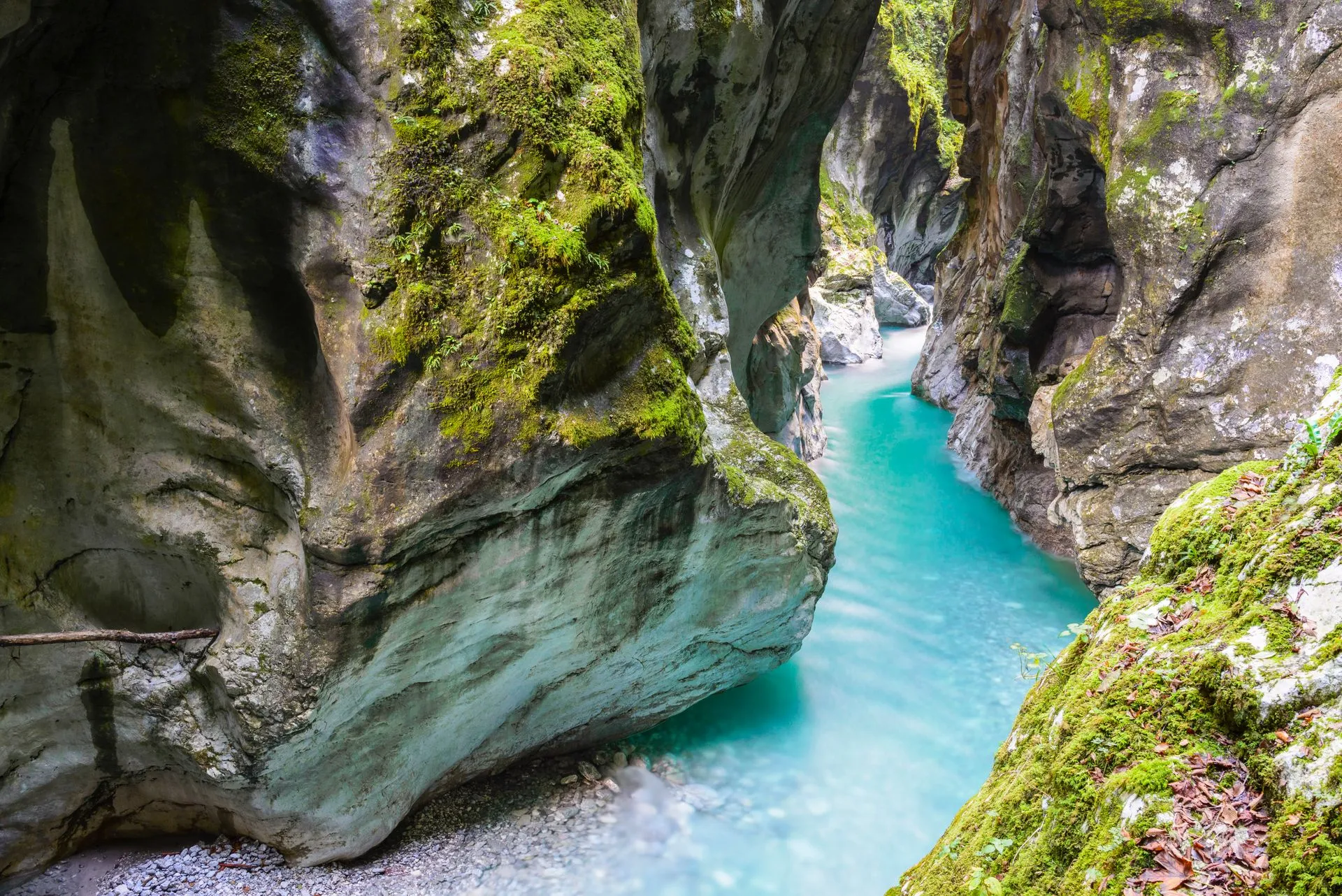
3. Soča days towards Kobarid and Bovec
Towards the Soča Valley, the landscape becomes more rugged and the water remarkably clear. These are days for those who enjoy walking along a river, with views, gorges, and variety in the valley.

Practical tips
Best time to travel
May, June, and September are the most pleasant months for many hikers. Conditions are often good for hiking, and the pace is slower than in the height of summer. July and August can be hot, so it helps to start early and take plenty of water with you. Hiking is often possible from mid-March to mid-November, depending on the weather and conditions.
Use public transport wisely
Public transport can be part of your plan, not just a backup. For instance:
- if the weather changes
- if you want to shorten a longer stage
- if your legs are asking for a rest day, but you still want to continu to the next place.
Connections are often more frequent in the summer. In spring and fall, they may be somewhat more limited in some places. Therefore, be sure to leave some flexibility in your schedule.
Outfits and weather
Bring sun protection, plus windproof and waterproof layers. Weather in the mountains can change quickly. A light rain jacket and an extra layer often make the difference between persevering and enjoying yourself.
Stay overnight
The trail is well suited to small-scale accommodations such as guesthouses and tourist farms, but also to hotels if you prefer comfort and convenience. Choose whatever suits your pace. Waking up calmly and enjoying a good breakfast will greatly enhance your hiking experience.

How to plan your own Juliana Trail trip
Choose your core vibe first (lakes, river valley, or mountain villages), pick your trip length, then add one flexible option (a rest day, a shorter stage, or a public transport day). You do not need to hike the full loop to feel the essence of the trail.

Frequently Asked Questions
- How long is the Juliana Trail?
About 270 km. - How many stages are there?
16 stages, with 7 optional extra stages. - Is it high alpine hiking?
Many sections run through valleys and villages with alpine views. Some days are more demanding, but it is not continuous high alpine terrain. - Can you shorten or skip stages?
Yes. On several parts of the route, buses or trains can help you connect or shorten a day. - What is the best season?
May, June and September are often the most comfortable. The broader hiking window usually runs from mid March to mid November, depending on conditions. - Are there any organized tours?
Yes. You can book these via the Julian Alps Booking centre. Experienced, local guides will put together a tailor-made program, including accommodation, luggage transfer, and private transportation.
On the Juliana Trail, you will discover a mix of culture, adventure sports, history, and impressive scenery.
Last verified: February 2026 | Author: Mijn Slovenië
Sources: Slovenia.info, National Geographic, Julian Alps, Mijn Slovenie, Kranjska Gora